 geocatalogue.geoportail.lu
Urban planning
Type of resources
Available actions
Topics
Keywords
Contact for the resource
Provided by
Groups
Years
Representation types
Update frequencies
status
Scale
-
-

-

-

-

This layer contains the cadastral parcels (version: 03/06/2019) used as a basemap for the sectoral master plans.
-

-
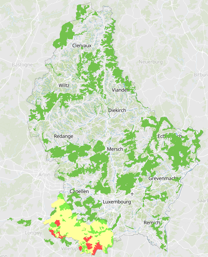
In UNESCO biosphere reserves, zones play a key role. Special attention has therefore been paid to the definition and delimitation of these zones: Biosphere reserves have three interdependent zones aimed at fulfilling three related functions, which are complementary and mutually reinforcing: • The core area(s) comprise(s) a strictly protected ecosystem which contributes to the conservation of landscapes, ecosystems, species and genetic variation; • The buffer zone surrounds or adjoins the core area(s) and is used for activities compatible with sustainable practices that enhance scientific research, monitoring, training and education; • The transition zone is the part of the reserve where more activities are allowed, allowing for socio-culturally and environmentally sustainable economic and human development. The selected core areas are all characterised by their common origin as sites of former open-cast mines that nature recolonised after their final closure at the end of iron ore mining in the late 1970s. The selected buffer zones consist of various Natura 2000 areas, but also of protected areas of national interest other than the former open-cast mines, and form an ensemble of the most diverse biotopes: orchards, meadows, wetlands and forests. The transition area includes all the municipalities and settlements, whether they are important economic centres or agricultural areas. It is therefore within this transition area that the actors of the territory, both public and private, will have to promote actions in favour of a more balanced urban development and of a sustainable and economic development respectful of the environment.
-
Construction period of the buildings (1999-2004,2004-2006, 2006-2010, 2010-2013, 2013-2015, 2015-2018) Sources: • 1999: BD-Topo • 2004: Remote sensing, Aerial-image • 2006: BD-Topo • 2010: Remote sensing, Aerial-image • 2013: BD-Topo • 2015: LIS-L Land-Cover • 2018: LIS-L Land-Cover (+LiDAR)
-
http://amenagement-territoire.public.lu/fr/plans-caractere-reglementaire/plans-sectoriels/logement.html
-
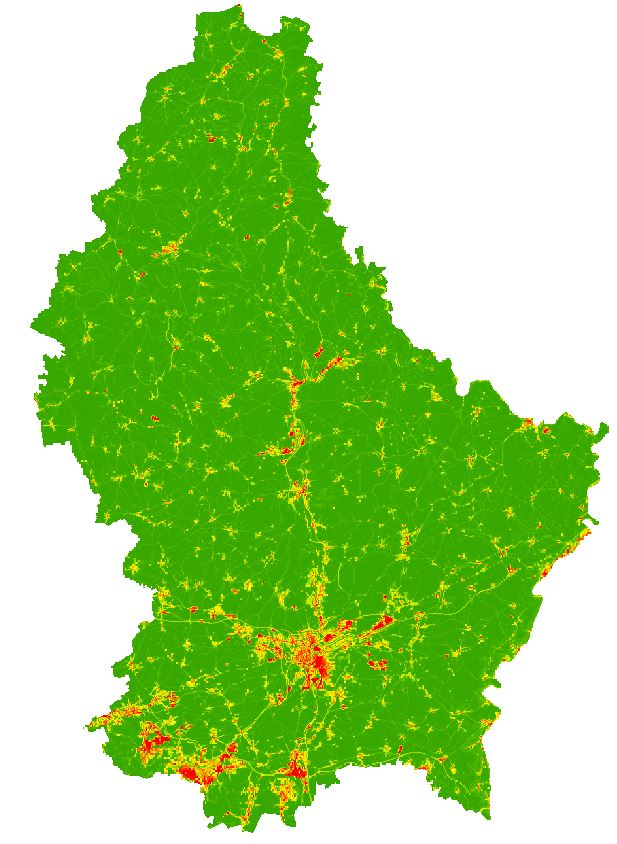
Imperviousness degree (Grid 100m) based on LIS-L Land-Cover 2018